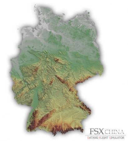
特点:8 \. Y: v0 r1 w8 b3 q5 U8 Q) B3 Z
5m NEXTMap based horizontal elevation spacing ; c; i5 F, r* t0 w: y256 times more detailed than the default terrain mesh in Flight Simulator X - X8 D7 c5 ]) ?
32-bit source data that translates into much higher vertical resolution in the dataset. 32-bit data compilation also reduces the striping and banding issues seen in other 16-bit terrain mesh renderings 4 u" l4 j# H! oFractional elevation sampling provides samplings to fractions of a meter vertically (e.g., 10.25m, 10.75m) compared to freeware mesh with only whole number samplings (e.g., 10m, 11m), which means smoother terrain on the ground and even smoother landings 9 l4 \' J) p) j _* r- \* U! |& o4 [: X# H" e! g, I* E' X+ `& M) L 百度网盘: 4 N8 R( M8 w9 o. y: v: u. j0 r

 IP卡
IP卡 狗仔卡
狗仔卡


 请点击此处下载
 提升卡
提升卡 置顶卡
置顶卡 沉默卡
沉默卡 喧嚣卡
喧嚣卡 变色卡
变色卡 显身卡
显身卡