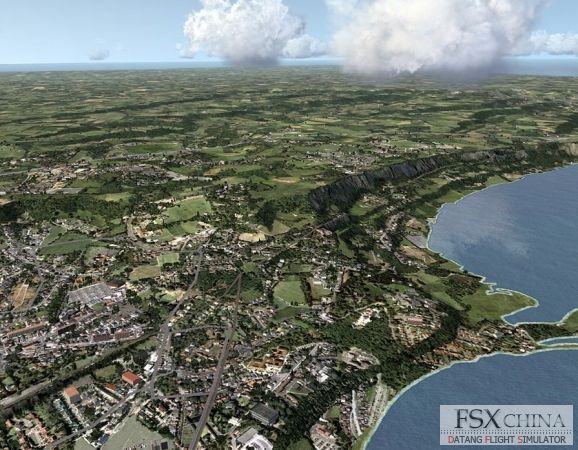
- 5m NEXTMap based horizontal elevation spacing 8 J6 f3 R8 n. w2 h1 ~1 P( t
- 56 times more detailed than the default terrain mesh in Flight Simulator X - W& {6 e6 u5 W4 e- K D) @
- 6 times higher resolution than the default terrain mesh in Flight Simulator X % G' H/ S( ?1 \1 x$ a
- 32-bit source data that translates into much higher vertical resolution in the dataset. 32-bit data compilation also reduces the striping and banding issues seen in other 16-bit terrain mesh renderings) B c$ C( i+ z8 v H7 Y
- Fractional elevation sampling provides samplings to fractions of a meter vertically (e.g., 10.25m, 10.75m) compared to freeware mesh with only whole number samplings (e.g., 10m, 11m), which means smoother terrain on the ground and even smoother landings & j# o. W! b0 i5 j! Q5 F7 o " w7 S$ s/ h" e

 IP卡
IP卡 狗仔卡
狗仔卡


 提升卡
提升卡 置顶卡
置顶卡 沉默卡
沉默卡 喧嚣卡
喧嚣卡 变色卡
变色卡 显身卡
显身卡